These aerial shots of The Witcher 3 map look like they were taken via satellite


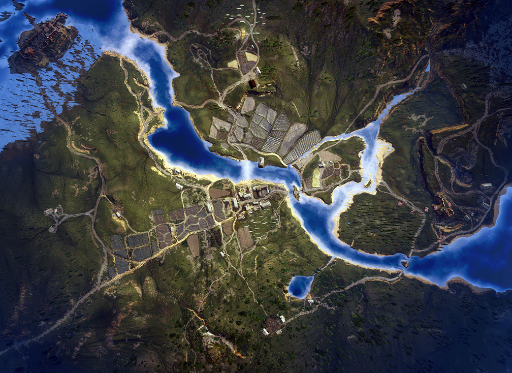
The Witcher 3 has a very large world map, and a very pretty one at that as demonstrated by some overhead shots posted online.
Taken by NeoGaf member EatChildren, who is a Vogue Australia cover model apparently, used the "unlock cam to take aerial shots" of Velen, Novigrad, Skellige's largest island, and White Orchard.
"Figured some would be interested in seeing the scale, as well as how the topography, roads, distribution of towns and fields look, all from above," he said in the thread.
It does look impressive. Like something NASA would take using satellite imaging, or what you'd see via Google Earth. Before you zoomed in too far and saw things you probably shouldn't have seen. Just Google it. There are plenty of things.
Anyway, you should head through the NeoGAF link to have a look at the others.
Thanks, PCGamesN.